Samothrace .. the island of the Great Gods
Route Athens - Alexandroupolis
Route Thessaloniki - Alexandroupolis
(More Routes)
Referred by mythology as island of Aeolus, Samothrace (you’ll see it spelt “Samothraki” too) is wreathed by mount Saos, the highest mountain on the Aegean islands; legend has it that Poseidon sat on its top to watch the Troy war. The attractiveness of the island is now made up of the steep peaks of the holy mountain of the ancients (the highest of which – 1.611 metres- is called “Fengari” = “moon”) the pebbly beaches, the streams and rivers, the pristine natural beauty, the famous healing sources, and the archaeological finds.
An island pregnant with history...
There is evidence of human activity on the rich with archaeological treasures island since the Neolithic times. But it’s the Kaviria Mysteries – religious event of great importance, equal to that of the Eleusinian Mysteries - that brought the island’s fame to the top. The grandeur of the archaeological prominence of Samothrace stretches over the 50-square-kilometres site of Palaiópolis, at 6,5km from the port of Kamariótissa.
Worth visiting:
- The Sanctuary of the Great Gods, site of a pre-Hellenic chthonic cult of Anatolian deities (Cabeiroi). The religious activity in the area spans 1100 years (7th c. BC - 4th c. AD). The major monuments of the Temple Complex are: the Propylon (285-281 BC), a monumental gateway dedicated to the Great Gods by the king of Egypt Ptolemy II Philadelphus, the Sacred Circle (end of 5th c. BC-beginning of 4th c. BC), the votive monument of Philip Arrhidaeus and Alexander IV (323-316 BC), the Anaktoron (1st c. BC), where initiation to the first degree (“myesis”) took place, the Arsinoeion, a large tholos (288-281 BC), the hall of choral dancers (Temenos), a large marble building with a key role in the worship of the Great Gods (c. 340 BC), the Hieron (325-150 BC) used for “epopteia”, the second degree of initiation, a stoa (1st half of the 3rd c. BC) that accommodated the temple visitors, the Nike monument (early 2nd c. BC) where the famous statue stood on a ship’s prow commemorating the victory of Rhodians over the fleet of Antioch III the Great.
- The Archaeological Museum (tel: +30 25510 41 474), where the archaeological site’s major finds are on display.
- The three-aisled Early Christian basilica (5th-6th c. AD) in commemoration of the visit of the apostle Paul. Only a few traces of its foundations can still be discerned.
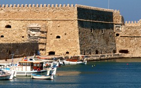
- The medieval castle of the Gateluzi family (1431-1433): The castle’s towers stand high on a hill overlooking the sea.
Samothrace NATUREally...
Stunning natural surroundings featuring rich vegetation among lakes and rivers will be etched on your mind forever. What is really special to the northern part of the island is its microclimate which favours a flora pandemonium. High altimeters are prevailed by plane, oak, cedar, and chestnut trees, while the lower parts look like a jungle of shrubs: over 20 species of them grow on Samothrace. Where the land is suitable for grazing, the wind bears the aromas of nature: thyme, oregano, and other herbs.
The island was once covered almost exclusively by oaks. The Martini Forest, lying between Therma and Karyotes, is a perfect example of what is left from that period.
Hundreds of crystal watered streams flow from mount Saos to rush through the forests all the way to the sea. On their way, they form waterfalls and stone basins, the so called “váthres”.
As a matter of fact, the streams and the waterfalls are the landmarks of the island. A pair of the best of those are the stream of Foniás (=”killer”) and its tallest waterfall (Kleidwsi – 35m high). A nature wonder in the form of a waterfall is situated in the Northeast; it’s Kremastó. The water there goes through some iron rocks to obtain a sweet, reddish colour before fiercely ending into the sea. Behind the water mass there is a cave to be explored. Other well-known waterfalls are Kakiá Pláka, Karyá, and Griá Váthra.
Along the north and the eastern coastline there are wetlands formed seasonally. Migratory birds call at the mouth of Foniás, at the wetland of Vdelolimni, whereas the lagoon of Agios Andreas near Kamariótissa is popular with birdwatchers.
But don’t forget you are on an island with rugged, mostly pebbly beaches, some of which are accessible only by boat. The beach of the Gardens with the black and gray shiny pebbles stands out. In the south, there is the only sandy –thus most cosmopolitan- beach of the island, Pachia Ammos (= “thick sand”) where you can marvel at the –perched-on-a-steep-rock chapel of Panagia Krimniotissa. Rent a boat here for a tour around the otherwise inaccessible areas of Katárti, Spiliés, Váto, Kremastó, Grias ta Paniá, and Gyalí. The fascinating bottom of the sea and the underwater life abundance appear transparent through the crystal clear waters.
An alternative tourism paradise
The imposing mountainous heart of the island paired with its pristine nature are just what explorers and adventure lovers could ever wish for: crossing gorges, trekking, mountaineering, mountain bike, paragliding, rafting, kayak, diving will be amongst your choices if you want to go active.
But Mother Nature has been generous to Samothrace in geothermal richness too: sulphurous therapeutic thermal springs welcome you to the village of Therma and to the spa facilities, where Greeks and foreigners seek and find health and wellness.
In the arms of hospitality
Chóra, a traditional village hanging on steep slopes, is the enchanting capital of Samothrace. Its cobbled streets lead high on the hill to the medieval castle of the Gateluzi family. The Folklore Museum and the Church of the Assumption (1875) are worth a visit here.
The busy port of Samothrace is Kamariótissa. Apart from being the point of sea connection with Alexandroupolis (in Thrace) it is also the starting point for the roads leading to all the villages on the island; Lakkoma, Profítis Ilías and Therma are some of them.
Source: GNTO
Accommodation
For your stay in Samothrace you can book a room in one of the hotels and Bed & Breakfast inns.
In Kamariotissa, Therma as well as in many other areas of Samothrace, there are hotels and accommodations of various categories and types (rooms to let, residences, Bed & Breakfast inns, studios, hostels, guesthouses and furnished apartments) that can satisfy every visitor's demands and needs for a pleasant and enjoyable stay.
You will find wonderful hotels, rooms and apartments to let of all categories and price ranges.
You can find a list of hotels and rooms to let, as well as special offers for low cost holidays, in the list of lodgings in the area and the accommodation offers and deals.
Access
Access to the island of Samothrace is possible by ship from Alexandroupolis Port.
You can reach Alexandroupolis by your own vehicle or by the Evros Bus. You can also go by train or airplane.
In the island, in case you don't have your own vehicle, you can use public transport that covers most of the island.
Samothrace Bus (KTEL) Town Hall tel: +30 25513.50.800
The best way to explore the island is by car so as to visit various places that the public transportation and the organized tours cannot reach.
Most parts of the island are easily accessed by the asphalt roads.
By ship:
Alexandroupolis Port is connected to Kamariotissa in Samothrace.
Samothrace Port Authority: +30 25510.41.305
Alexandroupolis Port Authority: +30 25510.26.468
For your convenience, you can use the route map on the field “Routes” with information about the mileage, the time you need and the route you will follow, selecting the points of interest.
Accommodation in Samothrace (Samothraki) island
For your stay in Samothrace, you can book a room in one of the hotels and Bed & Breakfast inns. In Samothrace town (Cho...
Location articles: Samothrace - Samothraki
Articles, tributes and reviews for the location with useful information and suggestions...


